By: CATALYST
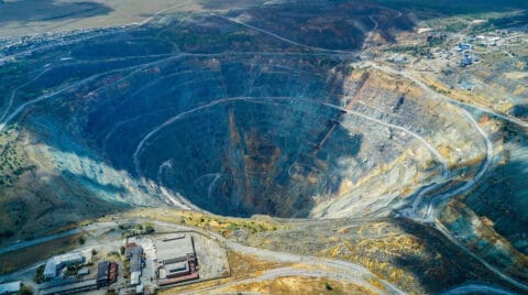
Late on Friday 9 March 2018, a portion of the wall connecting two tailings storage areas at the Cadia gold mine ‘slumped’. There had been no previous warning signs or cause for concern until earlier the […]
Read MoreBy: CATALYST
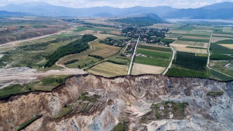
After receiving news on Saturday 10 June 2017 they would need to evacuate their homes, the lives of the Anargyroi community were completely transformed just hours later when 80 million cubic meters of earth travelled 3km […]
Read MoreBy: CATALYST
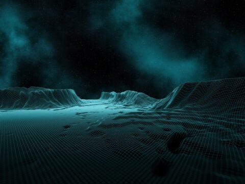
There are, though, growing applications among non-traditional industries. One of which is Coherence data. This powerful solution, which provides near-real time monitoring of output and personnel activity levels is increasingly being used by financial decision makers, […]
Read MoreBy: CATALYST
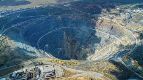
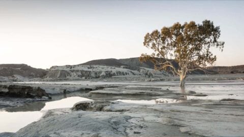
On 11 September 2022, the south east side of the Jagersfontein tailings pond collapsed. The resulting tidal wave of grey sludge slammed into the neighbouring environment and communities, wiping out properties, polluting waterways and claiming the lives of two people. 40 more were injured.
Read MoreBy: CATALYST
On the evening of Wednesday 7 December 2022, a massive leak was detected on the north-eastern Kansas stretch (Phase 2) of the Keystone pipeline, spilling more than 14,000 barrels of crude oil into the surrounding environment. […]
Read MoreBy: CATALYST
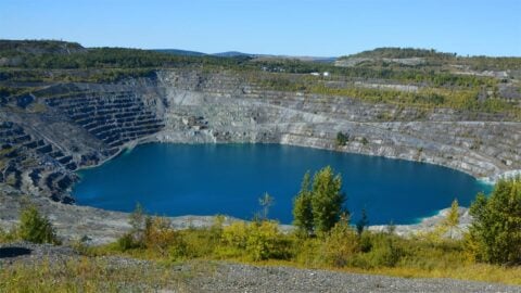
At its height, the Jeffrey mine in Asbestos, Quebec, produced halfof the world’s asbestos. It was the largest open pit asbestos mine on the planet, driving much of Canada’s growth to the largest world asbestos producer […]
Read MoreBy: CATALYST
On Monday 7 November 2022, a significant 150m wide breach impacted the eastern wall of the tailings storage facility at the Williamson diamond mine in Tanzania.
Read MoreBy: CATALYST
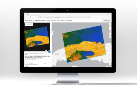
In 2022, CATALYST and Microsoft announced an exciting new collaboration. One that would see more scientists, researchers, and decisions makers around the world get access to earth observation data than ever before. This is the story […]
Read MoreBy: CATALYST
When authorities in Quebec were alerted to the significant risk of landslides in the La Baie area, they immediately set in motion measures to protect lives, property and infrastructure. The problem was, the warnings were only […]
Read MoreBy: CATALYST
This is the story of how Microsoft and CATALYST changed the way scientists, researchers and decision makers around the world could access earth data visualisation and analysis. It was achieved through a truly collaborative approach in […]
Read MoreBy: CATALYST
Looking to modernize delivery of high quality imagery faster, KSAT found their solution with CATALYST. Developing a brand new, custom ortho-mosaicking workflow, with pan-sharpening capabilities – CATALYST was able to quickly deliver an efficient solution. The […]
Read MoreBy: CATALYST
PG Ventures, the digital innovation arm of TSR Poland, discovered the powers of CATALYST’s ground displacement data when exploring solutions to address issues related to abandoned mines. What followed was a collaboration – made possible through […]
Read MoreBy: CATALYST
Canada’s Pollutant Inventories and Reporting Division (PIRD), a division of Environment and Climate Change Canada (ECCC) faces the massive task of creating a greenhouse gas inventory for the entire nation. A key part of this analysis […]
Read MoreBy: CATALYST
EOfactory scales up to provide geospatial users nearly limitless image processing capabilities using CATALYST Microservices Platform. Results: A nation-wide orthorectification of 10,000 images that now takes three days will be finished in five minutes with CATALYST […]
Read MoreBy: CATALYST
What is our country’s estimated crop yield this year? How much food will we need to import? Will we have enough water for our nation’s needs? How can we expect our cities to expand? What new […]
Read MoreBy: CATALYST
CATALYST has a full set of object-based image analysis (OBIA) tools that can be used to quickly and accurately extract impermeable land area on a per parcel basis. Imagery is segmented based on the shape and […]
Read MoreBy: CATALYST
The United Nations Office on Drugs and Crime (UNODC) operates several projects that provide detection data to governments where illicit crops are grown including Colombia, Peru and Bolivia (for coca), Afghanistan, Laos, and Myanmar (for opium), […]
Read MoreBy: CATALYST
Leveraging CATALYST Enterprise’s rapid processing capability made it possible to optimize image selection from over 50,000 archive RapidEye images. Results: Using commercially available data such as RADARSAT-2 and TerraSAR-X, Geomatica InSAR is suitable for any land […]
Read MoreBy: CATALYST
Manual GCP and tie point collection were wasting valuable man-hours and creating inaccurate results. A new solution with ArcGIS 10 integration was required. PCI Geomatics’ GeoImaging Tools software seamlessly integrates data from multiple sources into any ArcGIS […]
Read MoreBy: CATALYST
To identify stressed vegetation in the most cost-effective way possible, high-resolution satellite data can be purchased in areas covering the fields in question. Five-meter resolution RapidEye imagery is ideal to investigate identified areas of crop stress […]
Read More