To identify stressed vegetation in the most cost-effective way possible, high-resolution satellite data can be purchased in areas covering the fields in question. Five-meter resolution RapidEye imagery is ideal to investigate identified areas of crop stress before deploying expensive and labor-intensive specialists directly to site. The diagram below illustrates the major steps required to perform an analysis of agricultural fi elds for the purpose of assessing chlorophyll and leaf area (vegetation density) measurements to identify stressed vegetation.

Results:
Our assessment identified three agricultural fields that displayed symptoms of vegetation stress due to low relative VI values. These three fields were analyzed using CATALYST Professional software to identify whether the low VI values were, in fact, a cause of stress or a result of a different problem (I.e. sparse vegetation cover).
RapidEye
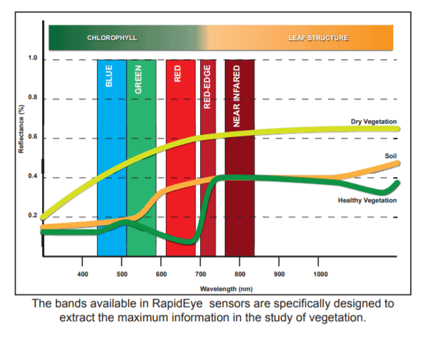
The RapidEye constellation consists of five satellites with an orthorectified resolution resampled to five meters. The constellation collects up to 6 million square kilometers a day, making it possible to cover large areas in a short time. Most importantly, the Rapideye sensors contain a unique spectral red-edge band, which is sensitive to detecting and measuring chlorophyll in flora.
About Catalyst
CATALYST is a PCI Geomatics brand, which has been introduced to put our leading edge technology into the hands of decision makers. We’re a startup – with hundreds of algorithms, scalable solutions, and decades of experience.

The results of the MCARI and MTVI-1 calculations from site 3 display a stark contrast from the results of sites 1 and 2. There are two obvious areas in site 3 that experience low MCARI values and high MTVI-1 values Only you can determine if a remote sensing workflow is the right approach to cost savings for your crop management, but studies like this show how easily one can be implemented while showing instant results. To find out more about how to do this and more, contact PCI Geomatics at [email protected].
