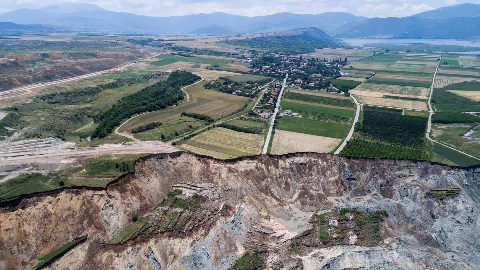
After receiving news on Saturday 10 June 2017 they would need to evacuate their homes, the lives of the Anargyroi community were completely transformed just hours later when 80 million cubic meters of earth travelled 3km and struck their village.
The subsequent widespread destruction left authorities no choice - complete demolition of every home in the area.
In this edition of Mine Shift, we use historical satellite imagery combined with CATALYST InSAR analysis of the Amyntaiou Lignite Mine to explore ground displacement levels across the site in the build up to the event.
The results prove extremely interesting and highlight the value of CATALYST InSAR in identifying risks and liabilities prior to failure events, supporting more informed due diligence, as well as – in the worst case scenario - strengthening emergency response protocols.