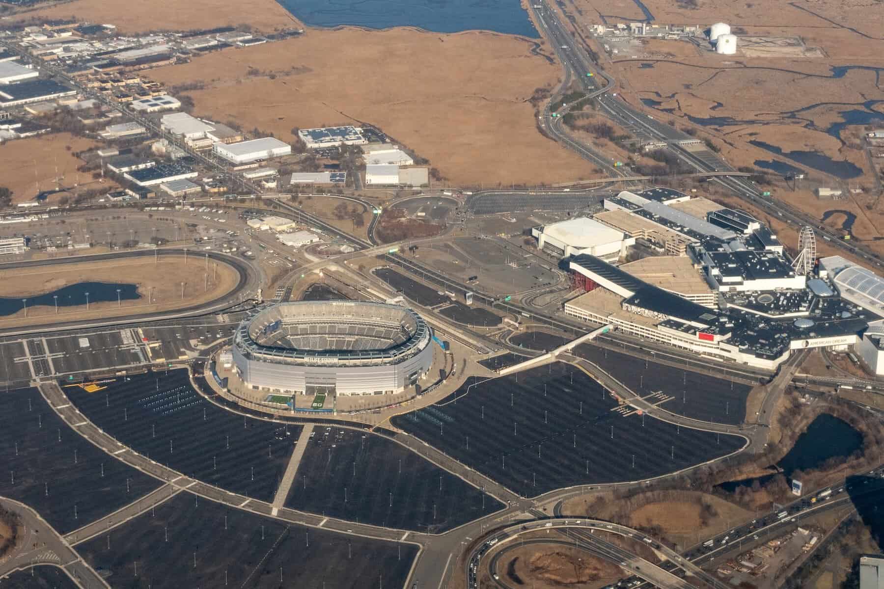
Seeing Beyond the Broadcast: Tracking Transformation of a Football Pitch from Space
CATALYST used multispectral satellite data to monitor FIFA World Cup 2026 pitch conversions and highlight the potential use of Earth Observation for asset management. A World Cup pitch is one of the most scrutinized surfaces on Earth, watched in real time by billions […]
Read more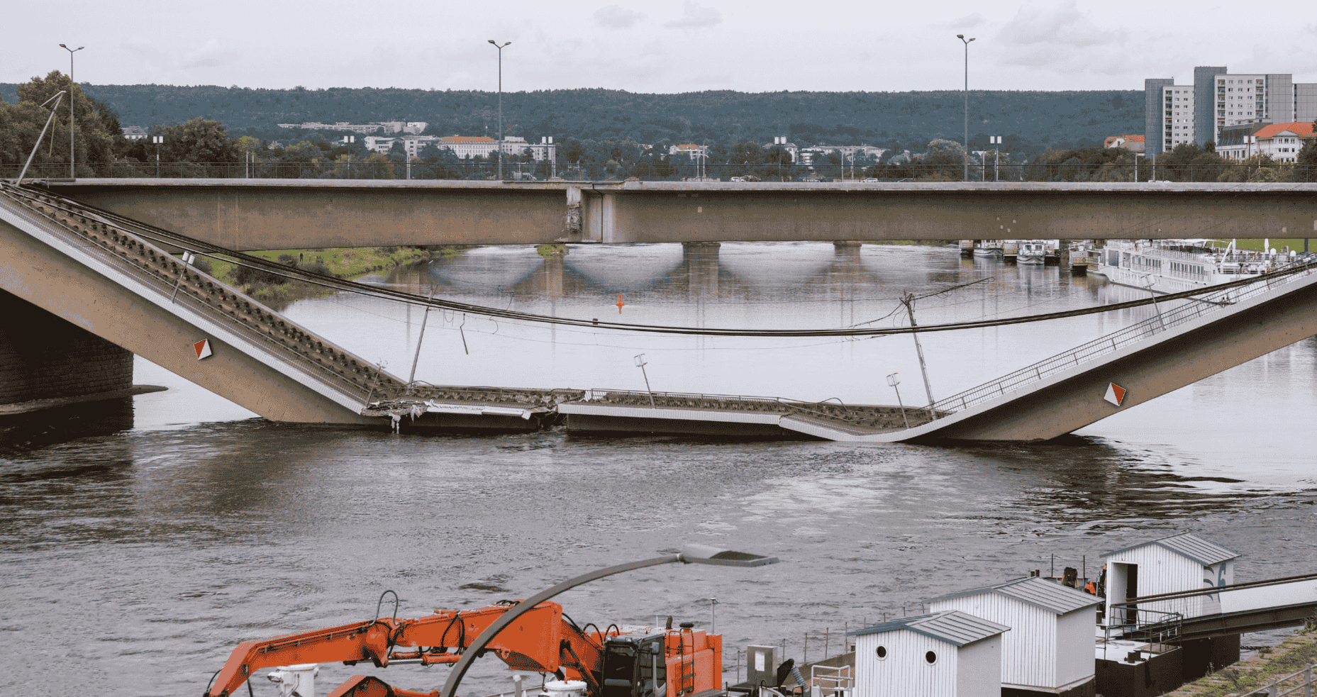
Ageing in Plain Sight: What the Carola Bridge Collapse Tells Us About Infrastructure Monitoring
Europe's infrastructure is ageing. Across the continent, many structures are approaching or exceeding their design lives, representing a substantial and growing maintenance liability. Most of the time, deterioration is gradual and manageable. On 11 September 2024, […]
Read more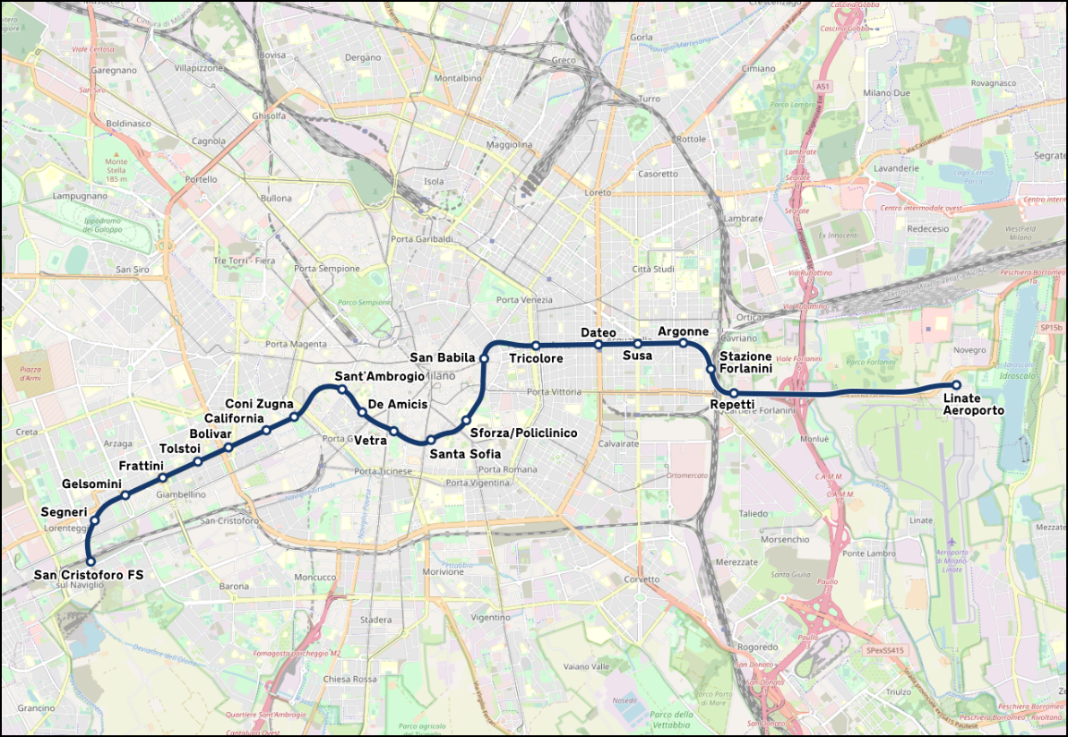
Monitoring Surface Deformation During Milan Metro Line 4 Construction Using InSAR
Tunnelling projects are among the most complex and challenging geoengineering endeavours, requiring a comprehensive understanding of risks including ground instability, active faulting, groundwater ingress, and settlement-induced damage. As a result, engineers rely on a wealth of […]
Read more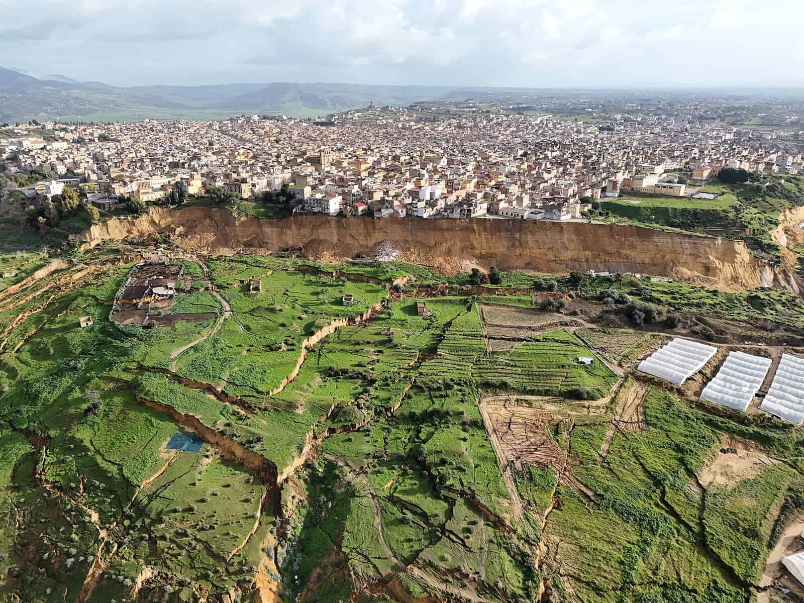
Proactive Land Displacement Analysis: The Niscemi, Italy Landslide Case Study
Satellite Interferometric Synthetic Aperture Radar (InSAR) provides spatially continuous ground deformation measurements across wide areas. As a fully remote technology capable of detecting millimetre-scale displacement, InSAR is increasingly being integrated into engineering projects as both a […]
Read moreWEBINAR: Proactive Land Displacement Analysis Capabilities
Upcoming Webinar | Wednesday, May 20 at 10:00 AM (ET): Integrating InSAR (Interferometric Synthetic Aperture Radar) into Engineering Geological Practice: Urban Excavation and Slope Failure Case Studies from Italy Learn how InSAR (Interferometric Synthetic Aperture Radar) can be applied to investigate […]
Read more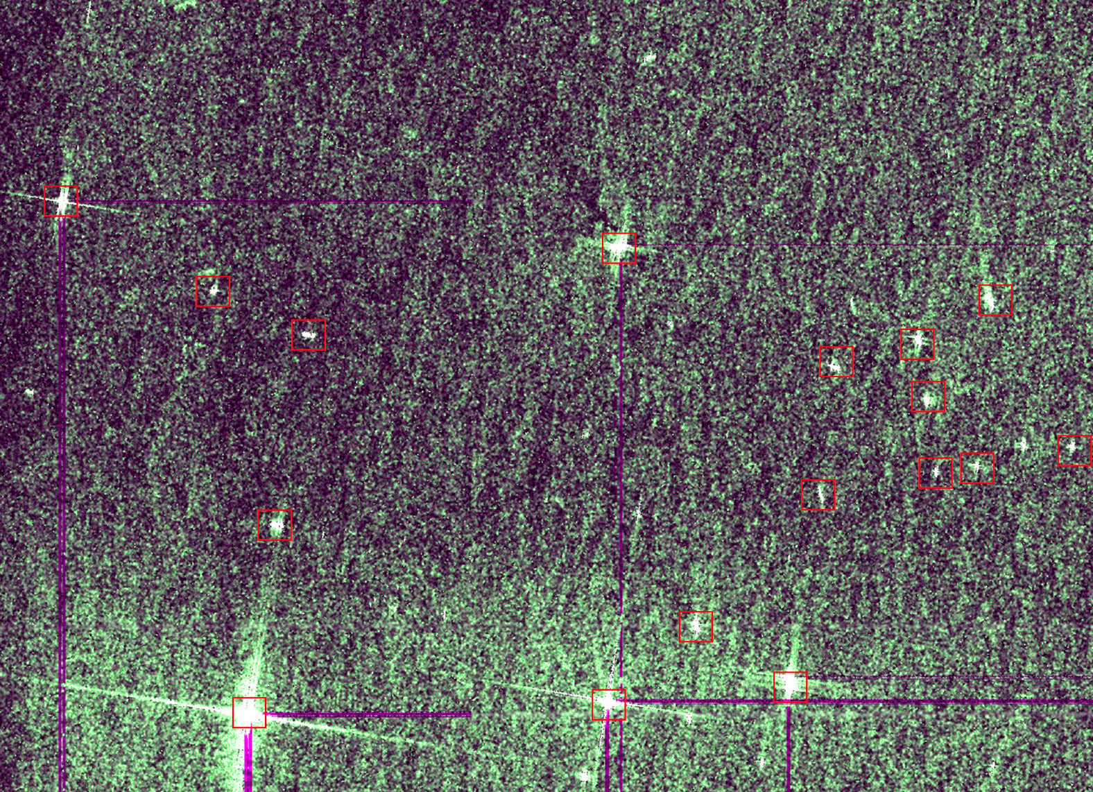
Supporting the Next Generation: CATALYST at the NASA Space Apps Challenge
How CATALYST Empowered Student Innovators at NASA’s Global Hackathon When fourth-year students Frank Tan and Isaac Huang walked into the University of Waterloo's NASA International Space Apps Challenge last October 2025, they were about to tackle […]
Read more
CATALYST Launches INSIGHTS Horizon For Defence and Government Agencies
Advanced Earth Observation Service Delivers Rapid Intelligence from Any Satellite Constellation for Maritime and Land-Based Security Operations TORONTO, 2025/10/30 — PCI Geomatics (DBA CATALYST), a leading provider of Earth observation analytics and intelligence solutions, announced the […]
Read more
Targeted Approach to Revolutionizing Utilities Vegetation Management Practices
Vegetation encroachment remains the leading cause of power outages for electric utility companies.Innovation using satellite imagery can reduce typical annual management cycle costs by 40%, prioritizingareas of the highest risk with targeted vegetation management solutions. Find […]
Read more
How satellite monitoring could have prevented Australia's $16 billion infrastructure oversight
The WestConnex project allegedly damaged tens of thousands of Sydney homes, with the New South Wales government paying compensation in the millions and with an ongoing class action suit for environmental damage caused by land subsidence. […]
Read more
Monitoring Challenges for Rail Operators: You Can't Manage What You Can't See
In rail network operations, discussions on how to navigate monitoring challenges frequently focus on questions of investment. CATALYST can lift the burden of monitoring challenges for rail operators. New Civil Engineer magazine highlighted that only 9% […]
Read more
WEBINAR: Breaking the Cycle with Condition-Based Vegetation Management
Discover how regular network-wide insights on current vegetation conditions can focus inspections and pruning on your highest risk areas. About This Webinar The Need to Use Resources Efficiently Managing vegetation is costly with major U.S. Utilities […]
Read more
CATALYST Launches INSIGHTS Vegetation Management to Enhance Utility Grid Resilience
Advanced Satellite-Based Monitoring Optimizes Vegetation Management, Reducing Outages and Operational Costs Toronto, Harwell 05/03/2025 — CATALYST is revolutionizing one of Electric Utilities' biggest operational challenges with the launch of INSIGHTS Vegetation Management, a satellite-based monitoring service […]
Read more