Upcoming Webinar | Wednesday, May 20 at 10:00 AM (ET): Integrating InSAR (Interferometric Synthetic Aperture Radar) into Engineering Geological Practice: Urban Excavation and Slope Failure Case Studies from Italy
Learn how InSAR (Interferometric Synthetic Aperture Radar) can be applied to investigate slope instability in geologically complex environments, a capability that is becoming increasingly important for infrastructure owners, asset managers, and engineers.
In this session, we will explore how satellite-based deformation data supports risk assessment, construction monitoring, and geological interpretation through two contrasting case studies from Italy.
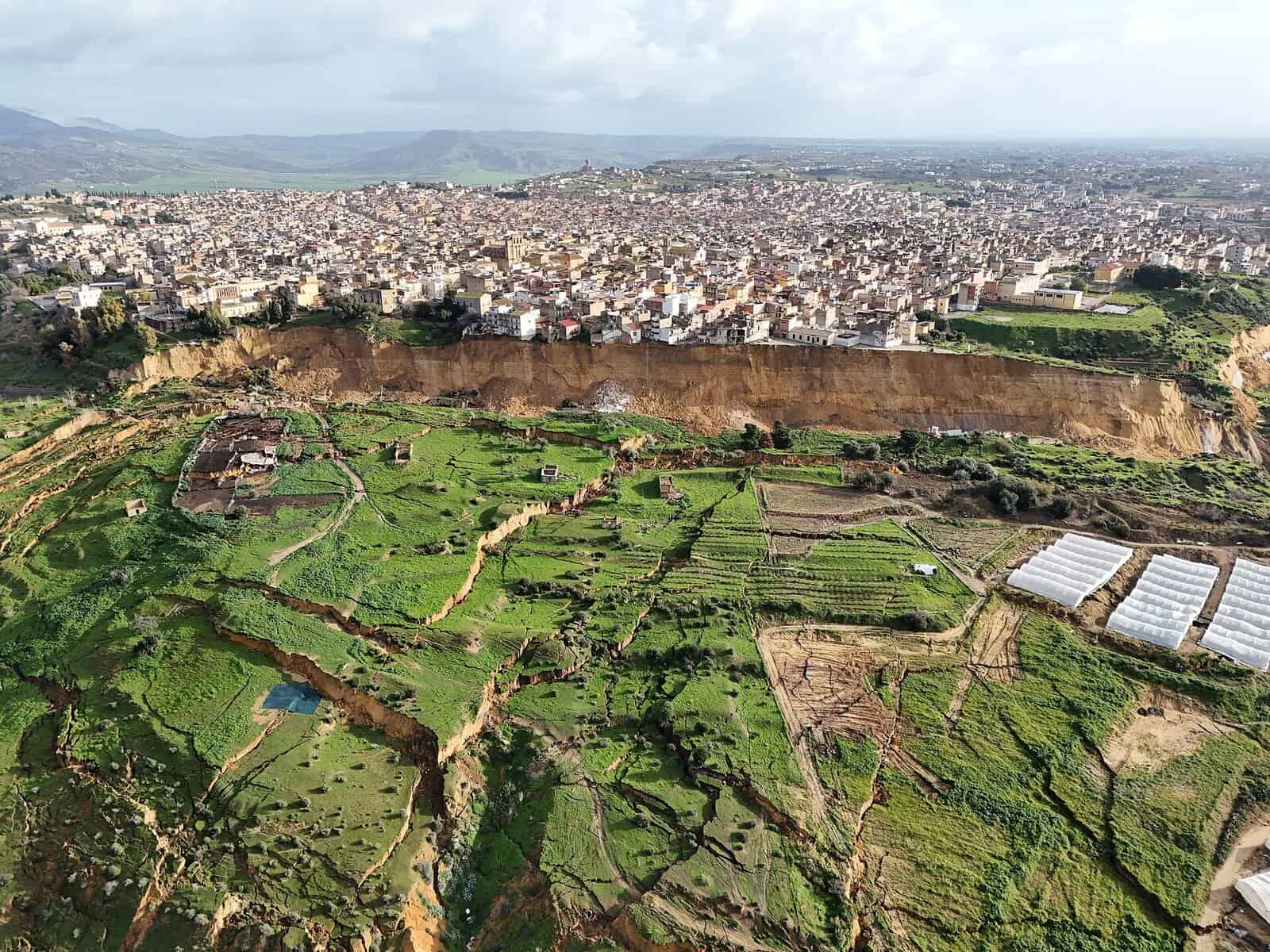
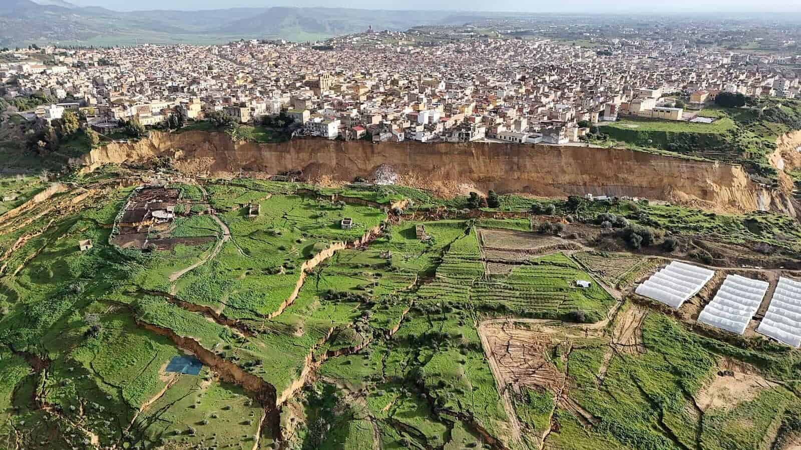
Niscemi Landslide (January 2026)
Discover how InSAR leverages satellite archive data to reconstruct the temporal evolution of instability. From long term deformation trends to short term acceleration before failure, this case highlights how retrospective, quantitative insights into ground behaviour can be achieved. This type of historical analysis provides a level of understanding that conventional ground investigations cannot replicate.
Milan Metro Line 4 Expansion (2019 to 2021)
See how InSAR was used to establish baseline conditions and monitor millimetre scale subsidence during tunnelling beneath a dense urban environment. This case demonstrates the value of consistent, wide area satellite monitoring for managing ground movement in complex city settings.
What you will learn:
• How InSAR quantifies displacement from individual buildings over days to regional deformation patterns over years
• How deformation data can be correlated with environmental data to identify the triggers and mechanisms driving slope movement
• How wide scale and site-specific analysis supports more informed site characterisation and stronger risk assessments
Presenters

Dr. Ben Conway-Jones is an InSAR Scientist at Catalyst Earth, working with clients across the full project lifecycle, from initial scoping through data processing, analysis, and delivery.
With a background in geology, Ben specializes in interpreting remote sensing data and translating it into meaningful insights that inform engineering and infrastructure decisions. He holds a PhD in Earth Science from the University of Cambridge and an undergraduate degree in Geology from Imperial College London.

Cristina helps organizations leverage satellite and aerial data within their own workflows, equipping teams with the tools and expertise to analyze complex geospatial data and generate practical outcomes.
She also collaborates with internal development teams to enhance software capabilities based on client needs and real-world applications.
Customer Success Manager at Catalyst Earth with a background in remote sensing and GIS, and over 15 years of experience in technical support and customer success.
Register Here