Results:
A nation-wide orthorectification of 10,000 images that now takes three days will be finished in five minutes with CATALYST Microservices, and it opens up the possibility to deliver not only national level information products but also global datasets.
Perenco
The Perenco Group currently operates over 90 wells and four production gathering stations within a 100 km long zone near Diyarbakir, South East Turkey. Perenco’s export facility exports crude oil to Mediterranean seaports. With daily production of 8 030 barrels of oil equivalent per day (net share), Perenco is the largest foreign oil producer in the country today.
About Catalyst
CATALYST is a PCI Geomatics brand, which has been introduced to put our leading edge technology into the hands of decision makers. We’re a startup – with hundreds of algorithms, scalable solutions, and decades of experience.

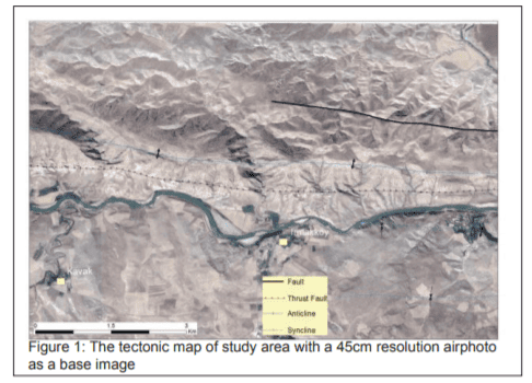
Organizations involved with petroleum exploration have long trusted remote sensing for many areas of oil and gas exploration, yet have traditionally eschewed the method as a means to delineate different types fault zones or folds zone from each other. Lineament analysis of remotely sensed data can give very important information of the tectonic structures.

