
Every day, earth imaging satellites deliver large volumes of critical information about our natural resources, our cities, our transportation, our climate, and more. In a way that traditional maps cannot, these images provide detail and context that is central to our understanding of our planet, our lives, and our future.
Results:
The growing number of enterprises leveraging raster images will benefit greatly from using Oracle 10g GeoRaster for storing and managing raster data in the database infrastructure. Though Oracle provides basic mechanisms for managing spatial and raster data in the database, PCI Geomatics software extends these capabilities significantly through automated uploading and downloading of data to Oracle, support for a broad variety of raster and vector file types, and advanced functions for remote sensing, photogrammetry, GIS, and mapping.
Map Generating Server
Using prepared map templates, maps can be generated automatically from vector and image layers – even from specified regions within/across data layers – stored inside the Oracle database. Focus makes this possible by acting as an XML-RPC server. XML-RPC is a remote procedure call, using HTTP as the transport mechanism and XML for encoding. XML-RPC is designed to be as simple as possible, while allowing complex data structures to be transmitted, processed and returned.
About Catalyst
CATALYST is a PCI Geomatics brand, which has been introduced to put our leading edge technology into the hands of decision makers. We’re a startup – with hundreds of algorithms, scalable solutions, and decades of experience.

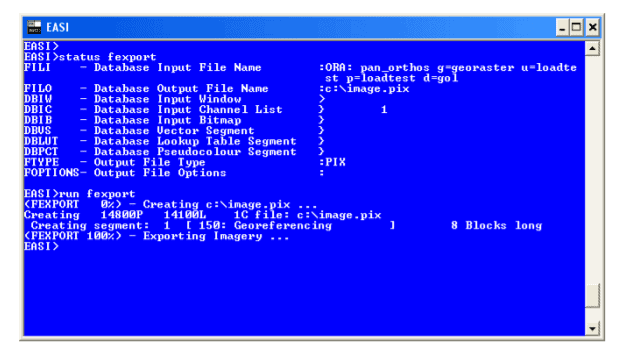
The GeoRaster ETL ProPack contains a set of pluggable functions for loading raster and vector data into Oracle 10g. The software development kit supports the following programming languages: Using PCI Geomatics Software with Oracle 10g Spatial and GeoRaster Page 11 • Python – for creating scripts that can support complex spatial data processing • Java – for using PCI algorithms in an enterprise environment • C/C++ – for building high performance systems
Custom development: accessing PCI and Oracle with Python, Java, and C/C++