Home » Tutorials » Vector Analysis Tools In CATALYST Professional
Vector analysis tools are fundamental to Geographic Information Systems (GIS), enabling users to manipulate, combine, and analyze spatial features to extract meaningful information. Common operations such as buffering, dissolving, and overlay analyses are widely used for tasks including proximity analysis, feature aggregation, and the identification of spatial relationships between datasets.
This tutorial demonstrates how these tools can be used to perform geospatial tasks in Focus. They form the foundation of many GIS analyses and can be applied to a wide range of mapping and spatial decision-making workflows.
The CATALYST Professional demo data is used in this tutorial to demonstrate the different tools. The data can be downloaded through the following links:
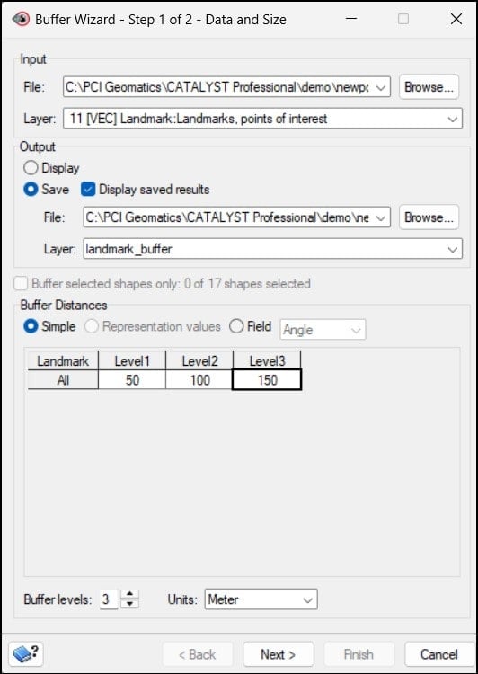
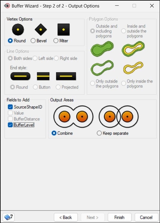
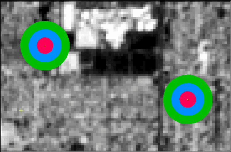
Buffers are margins defined at a specific distance around input vector features. The buffer tool creates polygon features, defining zones of proximity around points, lines or polygons. These zones can be generated at varying distances, allowing users to create multiple buffer levels for analysis. Buffers are commonly used in applications such as suitability assessments, impact analysis and risk evaluation.
The dissolve tool combines adjacent or overlapping vector features that share a common attribute into a single feature. During the process, shared boundaries between the selected features are removed, creating larger, continuous geometries. This technique is typically used to simplify datasets and aggregate features based on attribute values.
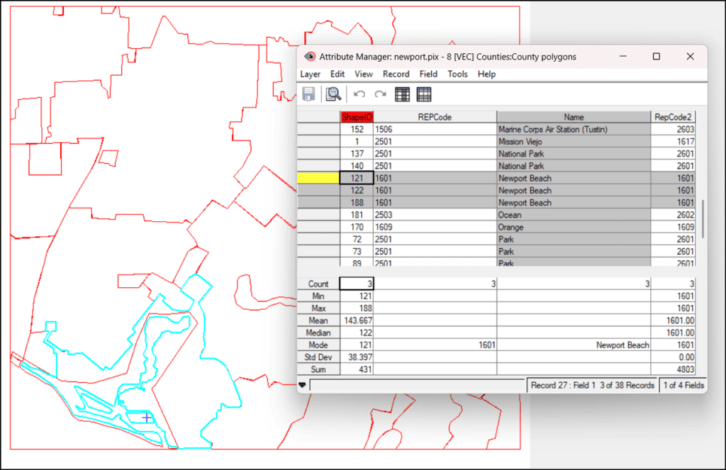
Using the Selection tool, select the shapes to be dissolved.
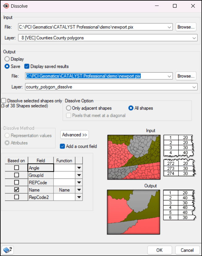
Navigate to the Dissolve tool: Analysis > Dissolve...
Select an input vector File and Layer to be dissolved.
In the Output section, the resulting layer can be saved to a file and/or displayed in Focus.
Select a Dissolve Option.
In the Dissolve Method section, select how the boundaries should be removed - either between shapes with the same representation value or attribute value.
In the attribute table, select the fields on which the dissolve would be based. Features with the same values for these attributes will be combined into one polygon feature.
Click OK.
Newport Beach polygons
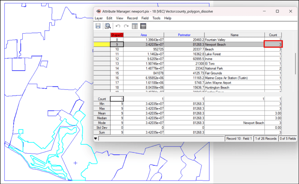
Dissolved Newport Beach polygons
Overlay Tool
The Overlay tool combines two or more vector layers based on their spatial relationships to create a new output layer containing the geometry and attributes of the input features. It's commonly used to identify areas where features overlap, compare datasets, and derive new spatial information.
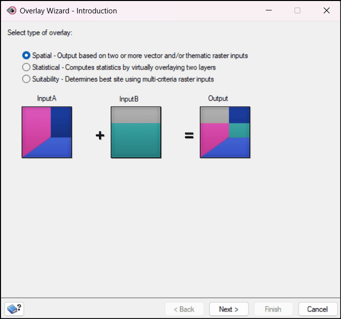
In CATALYST Professional, there are 3 types of overlay operations:
Spatial overlay is a vector analysis technique that combines two or more layers based on their geographic locations to produce a new output layer. The geometries and attributes of overlapping features are merged, allowing users to examine spatial relationships and derive new information from multiple datasets. Spatial overlay is commonly used in applications such as land-use analysis, environmental assessment, site selection, resource management, and more.
To perform a spatial overlay in Focus:
Navigate to the Overlay tool: Analysis > Overlay...
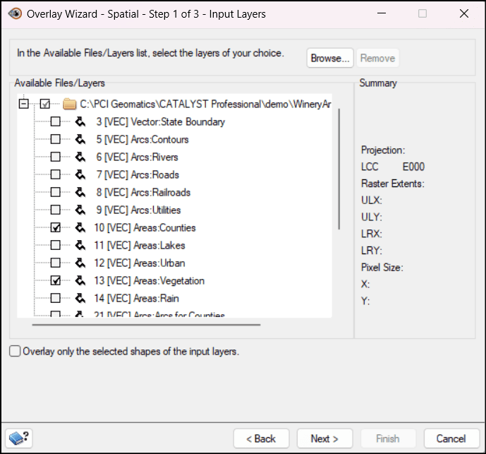
The Overlay Wizard opens, showing the 3 types of overlays. Select Spatial and click Next.
In the Available Files/Layers section, select the layers to be combined.
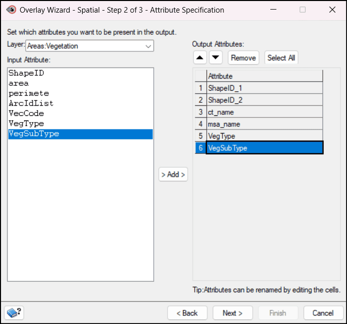
Click Next to go to the Attribute Specification step.
In the Layer dropdown field, select a layer.
Select an attribute in the Input Attribute section and click Add to include it in the output file. The attributes are added to the table under Output Attributes. Here, they can be removed, arranged and edited.
Repeat steps 5 and 6 for each overlay layer.
Click Next to go to the Output step.
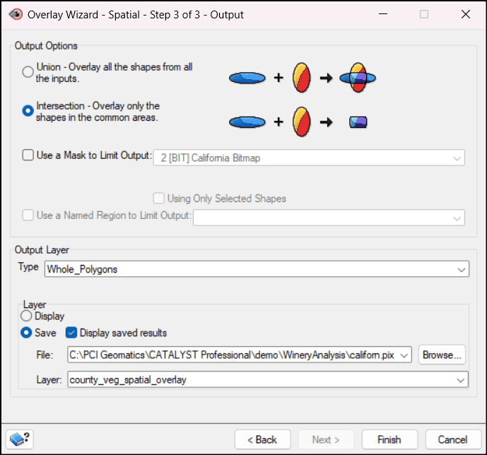
The Output Options section has two overlay options:
Union - joins all shapes from all the inputs
Intersection - includes only overlapping shapes
Under Output Layer, select a layer Type.
The output layer can either be displayed only or saved to a file layer.
Click Finish.
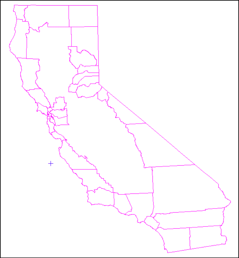
California counties
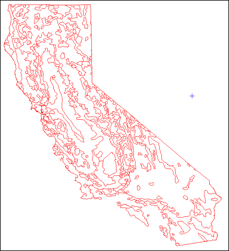
California vegetation
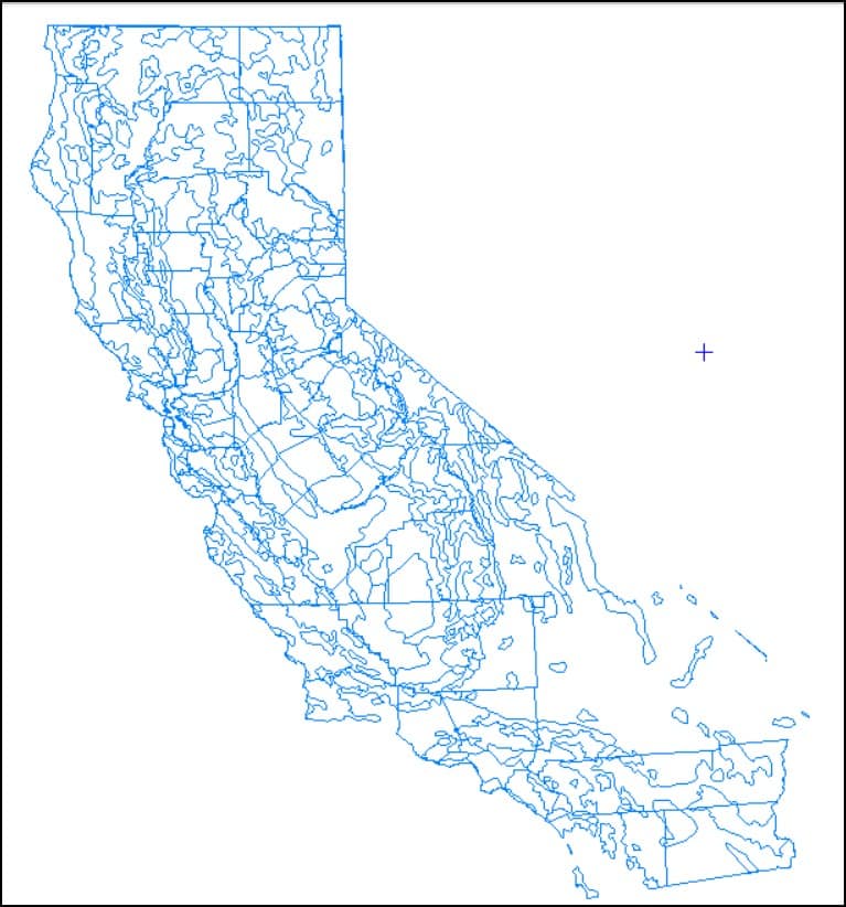
Spatial overlay of vegetation in counties in California
Statistical Overlay
Statistical overlay transfers attribute information from one vector layer to another based on their spatial relationships. The destination layer (Primary Input) receives attributes from the Secondary Input layer.
To perform a statistical overlay in Focus:
Navigate to the Overlay tool: Analysis > Overlay...
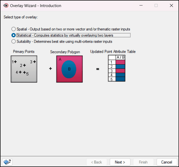
The Overlay Wizard opens, showing the 3 types of overlays. Select Statistical and click Next.
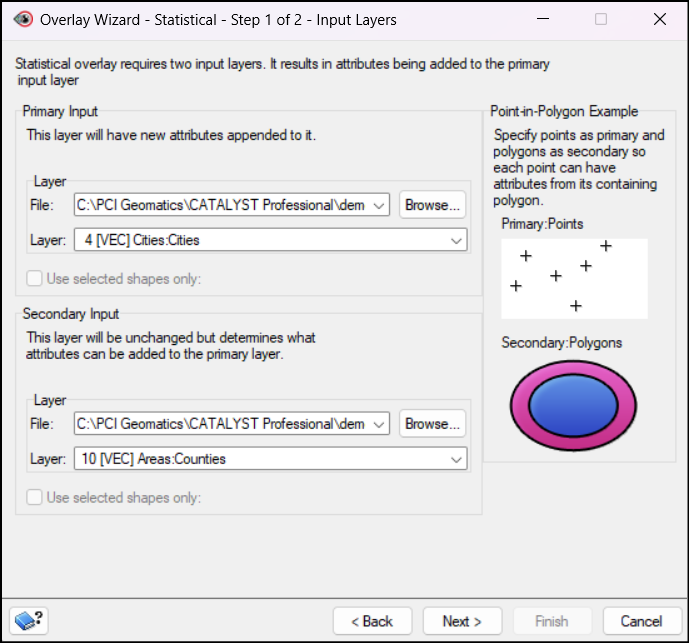
In the Primary Input section, choose a File and Layer that will receive the attributes from the other layer.
In the Secondary Input section, select the File and Layer whose attributes will be transferred.
Click Next.
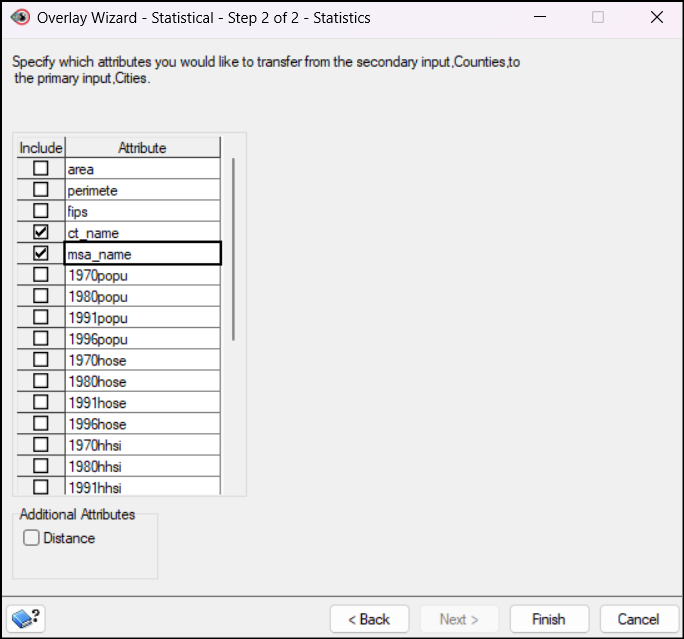
In the Statistics step, select the attributes to be transferred from the table.
Click Finish.
Counties of cities in California
Suitability Overlay
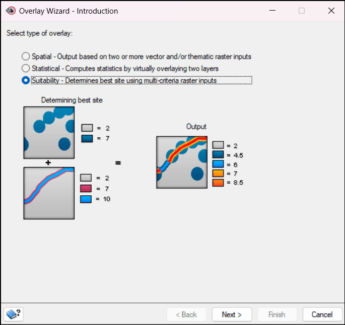
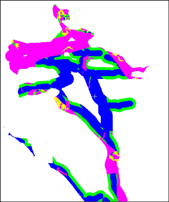
Suitability overlays analyze the weights of data to determine the most appropriate result by combining and evaluating multiple spatial factors. Each input layer represents a different criterion with an assigned weight to calculate a suitability score. This technique is commonly used in applications such as site selection, land-use planning, hazard assessment and so on.
To perform a suitability overlay in Focus:
Navigate to the Overlay tool: Analysis > Overlay...
The Overlay Wizard opens, showing the 3 types of overlays. Select Suitability and click Next.
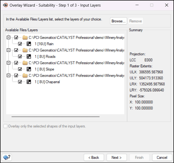
In the Available Files/Layers section, select the layers to be weighed.
Click Next.
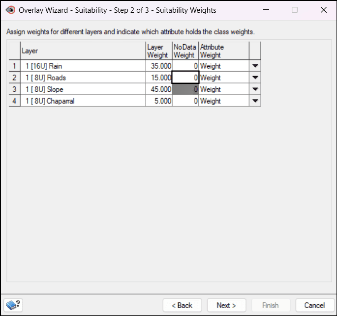
In the Suitability Weights step:
Enter a number for the weight of each layer.
Enter a weight for NoData values.
Select the Attribute Weight values.
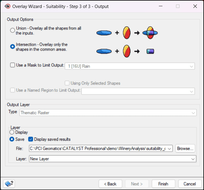
Click Next to go to the Output step.
The Output Options section has two overlay options:
Union - joins all shapes from all the inputs
Intersection - includes only overlapping shapes
Under Output Layer, select a layer Type.
The output layer can either be displayed only or saved to a file layer.
Click Finish.
"*" indicates required fields
Plugin ma-customfonts 4.0.5
Manage Cookie Consent
To provide the best experiences, we use technologies like cookies to store and/or access device information. Consenting to these technologies will allow us to process data such as browsing behaviour or unique IDs on this site. Not consenting or withdrawing consent, may adversely affect certain features and functions.
Functional
Always active
The technical storage or access is strictly necessary for the legitimate purpose of enabling the use of a specific service explicitly requested by the subscriber or user, or for the sole purpose of carrying out the transmission of a communication over an electronic communications network.
Preferences
The technical storage or access is necessary for the legitimate purpose of storing preferences that are not requested by the subscriber or user.
Statistics
The technical storage or access that is used exclusively for statistical purposes.The technical storage or access that is used exclusively for anonymous statistical purposes. Without a subpoena, voluntary compliance on the part of your Internet Service Provider, or additional records from a third party, information stored or retrieved for this purpose alone cannot usually be used to identify you.
Marketing
The technical storage or access is required to create user profiles to send advertising, or to track the user on a website or across several websites for similar marketing purposes.
To provide the best experiences, we use technologies like cookies to store and/or access device information. Consenting to these technologies will allow us to process data such as browsing behaviour or unique IDs on this site. Not consenting or withdrawing consent, may adversely affect certain features and functions.
Functional
Always active
The technical storage or access is strictly necessary for the legitimate purpose of enabling the use of a specific service explicitly requested by the subscriber or user, or for the sole purpose of carrying out the transmission of a communication over an electronic communications network.
Preferences
The technical storage or access is necessary for the legitimate purpose of storing preferences that are not requested by the subscriber or user.
Statistics
The technical storage or access that is used exclusively for statistical purposes.The technical storage or access that is used exclusively for anonymous statistical purposes. Without a subpoena, voluntary compliance on the part of your Internet Service Provider, or additional records from a third party, information stored or retrieved for this purpose alone cannot usually be used to identify you.
Marketing
The technical storage or access is required to create user profiles to send advertising, or to track the user on a website or across several websites for similar marketing purposes.