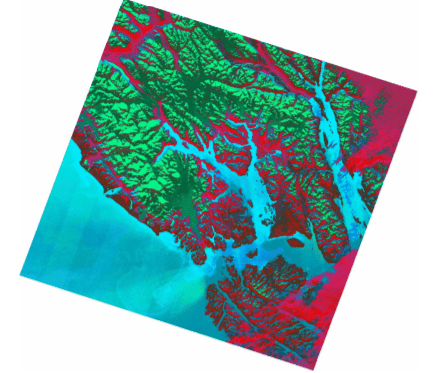
Glacier Bay National Park and Preserve, located on the South Eastern Alaska coastline, is home to spectacular glaciers and ice fields. The park is designated as a UNESCO World Heritage Site due to its glaciers and bio-diversity. Glacier Bay contains 11 glaciers, all of which converge into the bay, where glacial meltwater mixes with salt water of the Gulf of Alaska.

Results:
In conclusion, it can be surmised that using band ratios and an NDSI can both aid in the analysis of Snow and Ice within Glacier Bay. The RGB image is better suited for defining clear boundaries between snow/ice and the surrounding vegetation, rocks, and open water. The index image is better suited for analyzing transition zones between glacier ice flows, glacial melt, and the open water. Both of these images could be compared temporally to other images in order to recognize the patterns of glacier retreat or advancement within Glacier Bay National Park.
Methods
A Landsat 8 scene (Level 1 GeotTiff Data Product) of Glacier Bay was initially downloaded from the USGS Earth Explorer website. Using Catalyst’s Focus software, the image was added as a multispectral image and atmospheric effects were subsequently removed. The Image Channel Algorithm (ARI) was used for computing new band ratios to be applied to the RGB image.
About Catalyst
CATALYST is a PCI Geomatics brand, which has been introduced to put our leading edge technology into the hands of decision makers. We’re a startup – with hundreds of algorithms, scalable solutions, and decades of experience.

Snowfall rate, topography, and climate trends all factor in to whether a glacier is advancing or retreating. Glacial retreat is occurring throughout the bay’s east and southwest sides. Glacier advance is occurring on the west side due to consistent snowfall high in the Fairweather Mountain Range. The purpose of this poster is to display the topography, snow, and water within the bay using Landsat 8 satellite imagery.
