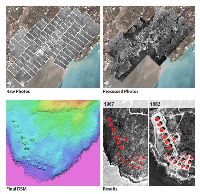
The Historical Airphoto System (HAP) system offers an automatic approach consisting of three main processing steps (Data Ingest, Coarse Alignment and Fine Alignment). Ingested imagery are provided approximate positioning that is further improved through the collection of Ground Control Points and Tie Points.

Results:
Through the HAP automatic workflow, historical aerial images from 1967 (183 images) and 1982 (64 images) were processed into an ortho-mosaic and Digital Elevation Model. The deliverables attained a positional accuracy less than 5 meters in relation to the reference imagery.
Methodology
The Historical Airphoto Processing (HAP) system offers an automatic approach consisting of three main processing steps (Data Ingest, Coarse Alignment and Fine Alignment). Ingested imagery approximate scene centres are derived using available information, which is then further improved through the collection of Ground Control Points and Tie Points.
About Catalyst
CATALYST is a PCI Geomatics brand, which has been introduced to put our leading edge technology into the hands of decision makers. We’re a startup – with hundreds of algorithms, scalable solutions, and decades of experience.

• Environmental Assessments • Civil Law/ Litigation • Bylaw Enforcement • Real Estate Evaluations • Land Cover and Vegetation • Natural Hazard Risk Assessment • Land Settlement Measurement • Forestry Growth Assessment • 3D Feature Extraction • 2D Feature Extraction • Environmental Remediation
Applications
