

Earth Data, Simplified
Check Out Our Preprocessed Interactive Demonstrations
As part of our Eastern Seaboard Monitoring Project, we reviewed Washington DC for potential ground displacement and discovered the following:
- An embankment near a runway at Ronald Reagan Airport is sinking at 11 mm per year
- A segment of the Washington Metro subway line is subsiding at 5 mm per year
- The area around a high-rise construction is subsiding at 5 mm per year
A few months ago, our team began an ambitious project, to monitor the risk of ground displacement in key cities along the eastern seaboard of the United States using InSAR. We picked this region because of noticeable ground displacement taking place and the concentration of critical infrastructure at risk in the area. Our most recent city, Washington DC, uncovered some unique findings that demonstrated the capability of satellite radar to detect a wide range of infrastructure risks in one of the most important cities in the world.
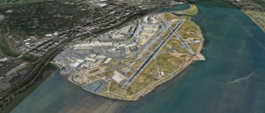
Runway sinking at Ronald Reagan Airport
Dozens of airports built on reclaimed land are sinking, for example, Kansai International Airport in Japan has subsided 38 feet since 1994. Similarly, Ronald Reagan National Airport has gradually expanded into the Potomac River on reclaimed land to accommodate larger and heavier aircraft. This land needs continued maintenance and construction consideration to manage subsidence, and currently has a project targeting a deep base layer of the soil beneath the airport. Our findings confirmed a sinking area on the edge of the Potomac.
- The area at the end of Runway 33 is sinking at 11 mm per year
- This runway sees 36 flight operations per hour, so unforeseen downtime due to reactive maintenance would be extremely costly
- Over 500 acres of the airport is made up of land dredged from the Potomac River
- Dozens of airports built on reclaimed land are sinking, with Kansai International Airport in Japan subsiding 38 feet since 1994
-77.031406, 38.849904
Assessment
- Sinking by 11mm/year (2015-2021)
Risk
- Runway damage
- Slope/retaining wall failure
- Runway downtime
Recommendations
- Inspect slope and runway
- Stabilize/reinforce slope if required
- Continue to monitor closely
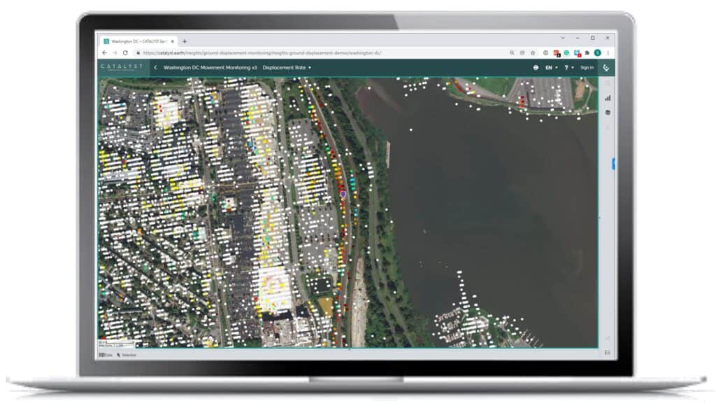
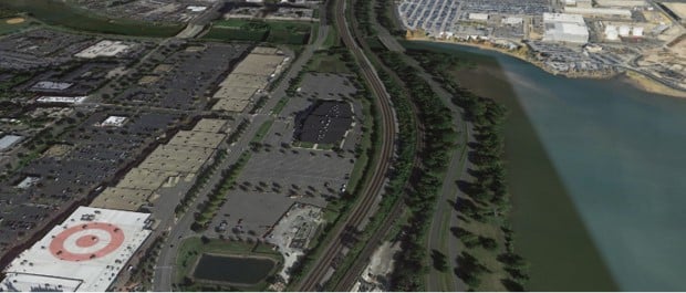
Washington Metro Railway Subsidence
Railways subside naturally over time due to the repeated burden of heavy loads, however subsidence can also be exacerbated by external factors such as ground swell. By using InSAR, we can look at large sections of a rail network over long periods of time, and deduce which areas need further attention. This can be seen in the section of rail below.
- With 626,000 daily rides, the Washington Metro is key for commuters and the shipment of goods around the DC area
- This section of rail is in one of the densest parts of the city, and is subsiding at 5 mm per year for over a kilometre
- Ground subsidence in railways can impact track speeds, travel frequency, weight restrictions, and down time due to maintenance
-77.046967, 38.836962
Assessment
- Sinking by 5mm/year (2015-2021)
Risk
- Bed slippage
- Track damage/failure
- Train derailment
Recommendations
- Inspect rail bed and rail
- Stabilize/reinforce rail bed if required
- Continue to monitor closely
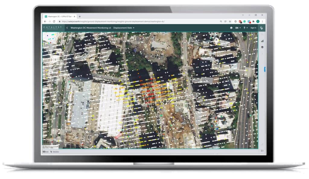
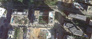
Subsidence in a High-rise Construction Zone
Knowing the ground displacement of a site before, during, and after construction can give property owners and developers the assurance that their buildings are stable and safe. One of the most common impacts of subsidence is damage due to private property. Cracks in the foundations of homes, condos, or commercial properties can lead to costly repairs, for example:
- Untreated damage from subsidence can decrease property values by up to 20%
- Subsidence has been identified as a potential contributing factor to the Surfside condo collapse, as it was sinking 2 mm per year, or a potential 2.5 inches over it’s 40 year lifespan
- The area around the condo construction below is subsiding at 5 mm per year
-77.055752, 38.862311
Assessment
- Sinking by 5mm/year (2015-2021)
Risk
- Foundation damage
Building Failure
Recommendations
- Inspect displacement on site
- Stabilize/reinforce foundation if required
- Continue to monitor closely
Ground displacement can also impact dams, electrical infrastructure, roadways, and many other types of infrastructure. Damage due to ground displacement related geohazards cost many of the world’s economies more money than hurricanes, earthquakes, tornadoes, and floods combined.
These areas and several other trouble spots have been identified, please feel free to explore in our available demo. Please watch for new findings from our future cities and if you would like to contact us to see how we can help you monitor your assets, please use the following email [email protected].
Check Out Our Preprocessed Interactive Demonstrations