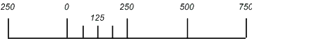
A scale bar is a visual aid to help you measure actual ground distances in an Area. It is marked with measurement units in proportion to the scale of the Area. Scale bars are anchored to a neatline or to an Area if a neatline is not set and are positioned in reference to that anchor.
You can create two types of scale bars:
- Line and Tick
- Bar

If you want to show two different scales, such as kilometers and miles, you must create two separate scale bars. If you want both scale bars lined up at zero, you must align them manually.
To add a scale bar to an Area, see Creating a surround. To open the Scale Bar Properties window, see Setting surround element properties.
The look of a scale bar is determined by its:
- General properties
- Scale bar type
- Division
- Subdivision
- Style
- Position (see Setting the updating behavior)
- Quick Style (see Selecting an existing quick style)