
MARKHAM, Ont. and STORRS, Conn. March 1, 2021
View this story in UConn Today.
CATALYST, a PCI Geomatics brand, is proud to partner with the University of Connecticut (UCONN) Global Environmental Remote Sensing (GERS) laboratory to establish a Center of Excellence to facilitate cooperation and knowledge exchange between the university and CATALYST scientists. Through the partnership, CATALYST is providing UCONN’s leading Earth Observation scientists, including Dr. Zhe Zhu and his team, with software licenses to support teaching and research.
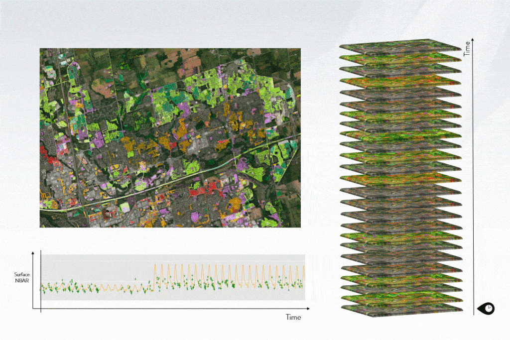
CATALYST has worked with Dr. Zhe Zhu’s innovative change detection algorithms to implement time series information derived from time series Landsat imagery for Environment and Climate Change Canada (ECCC) to map urbanization patterns in the Greater Toronto Area. Dr. Zhu’s Continuous Change Detection and Classification (CCDC) algorithms were implemented by CATALYST using a unique, object-based analysis approach.
“CATALYST partners with academic organizations globally including UCONN to enable scientists to further advance scientific progress in leveraging earth observation to study climate change. Exploring time series information derived from satellite imagery can provide insights into our stewardship of the land, and enable better decision making.”, said June McAlarey, President and CEO, at CATALYST.
“In my opinion, that’s a big step forward,” Zhu says. “I’m eager to collaborate and eager to help.”
For more information regarding CATALYST’s implementation of Dr. Zhe Zhu’s CCDC algorithm for the government of Canada, please follow this link:
https://www.gim-international.com/content/article/canada-applies-open-data-cube-technology-to-assess-nationwide-land-use-change
CATALYST is a PCI Geomatics brand, which has been introduced to put our rich technology for processing Earth imagery into the hands of decision makers. CATALYST provides proven algorithms rooted in photogrammetry and remote sensing to offer engineers, environmental managers, and other professionals accessible earth data measurements on a reliable basis derived with leading edge, scalable software solutions and platforms.