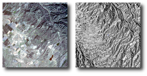
This example uses the SLASP algorithm to calculate the slope and aspect (or orientation) angles from a digital elevation model (DEM). The slope values range from zero to 90 degrees and represent the angle of incline for each pixel. The aspect angles range from zero to 360 degrees and represent the directions the slopes face relative to the top of the raster. Flat areas will have a zero slope, and their aspect value will be determined from a user-supplied value.
Figure 1. irvine.pix before and after running the SLASP algorithm