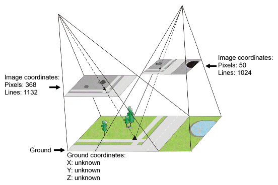
A tie point (TP) is a feature that you can clearly identify in two or more images and that you can select as a reference point, as shown Figure 1.
TPs do not have known ground coordinates, but you can use them to extend ground control over areas where you do not have ground control points (GCP). Used in rigorous models, aerial photography, optical satellite, and radar satellite math models, TPs identify how the images in your project relate to each other. In a project using the Rational Functions math model, in which you have imported the polynomial coefficients distributed with the data, you can collect TPs and GCPs to compute a transformation to improve the fit between the images.
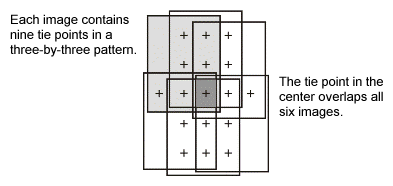
With projects in which you are using the Aerial Photography math model, you usually collect TPs in a three-by-three pattern over the image, as shown in Figure 2. Because the images have a 60 percent overlap between each other and a 20 percent overlap between the strips, you can use the three-by-three pattern to connect six overlapping images.
Projects using the optical satellite math model generally have fewer images, so you can collect TPs wherever overlap occurs. Because the overlap between satellite images is unpredictable, satellite imagery generally covers a large area containing a lot of ground control.