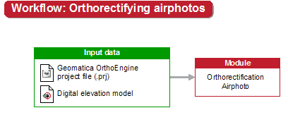
When your project is ready to produce orthorectified images, you can run the Orthorectification Airphoto module. This module geometrically corrects image scenes. With orthorectification, you can relate features in the image to their actual locations on Earth, take measurements, and make accurate decisions. Orthorectified images are necessary to produce an image mosaic.
For information on how to orthorectify your aerial imagery, see Orthorectification Airphoto module.
After you orthorectify your aerial imagery, it is advantageous to perform an accuracy assessment. To perform an accuracy assessment of the orthorectified images in CATALYST Enterprise, you run the the Automatic Accuracy Assessment module. The module can assess the absolute accuracy of the orthorectified images to a geocoded reference image, and the relative accuracy of all the orthorectified images in the project.