Orthorectification is the process of using a rigorous math model and a DEM to correct distortions in raw images. The rigorous math model provides a method to calculate the position and orientation of the sensor at the time of image acquisition. Creating the math model occurs during the ingest stage, and uses the exterior-orientation (EO) file and camera-calibration information provided. The quality of the orthorectified image relates directly to the quality of the rigorous math model and the DEM. A poorly computed math model, due to incorrect EO information or camera-calibration data, an inaccurate DEM, or a DEM incorrectly georeferenced to the math model will cause errors in the orthorectified images.
The Airphoto Ingest and Ortho module spawns a child job for each scene in the input folder so that they can be distributed among processing servers. Each child job imports an aerial image into the PCIDSK format and calculates a math model based on the camera exterior-orientation information and camera-calibration file. It then uses the raster DEM to orthorectify the image.
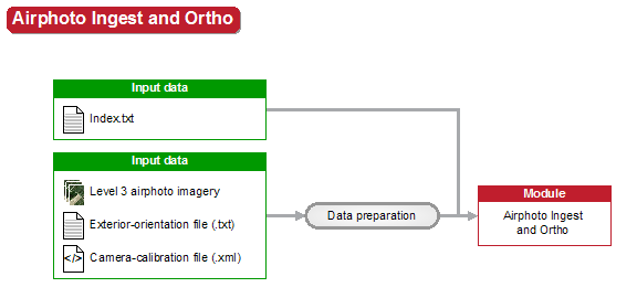
The following figure shows how, for each Level 3 scene in the folder, the Airphoto Ingest and Ortho module spawns one child job that creates an orthorectified scene. On completion of all child jobs spawned, the master job reports a completed state.
For more information on the module parameters, see the Airphoto Ingest and Ortho module.