By: CATALYST
Late on Friday 9 March 2018, a portion of the wall connecting two tailings storage areas at the Cadia gold mine ‘slumped’. There had been no previous warning signs or cause for concern until earlier the […]
Read MoreBy: CATALYST
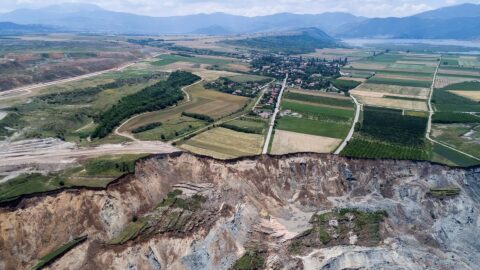
After receiving news on Saturday 10 June 2017 they would need to evacuate their homes, the lives of the Anargyroi community were completely transformed just hours later when 80 million cubic meters of earth travelled 3km […]
Read MoreBy: CATALYST
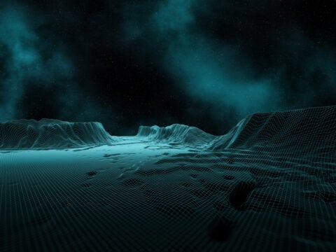
There are, though, growing applications among non-traditional industries. One of which is Coherence data. This powerful solution, which provides near-real time monitoring of output and personnel activity levels is increasingly being used by financial decision makers, […]
Read MoreBy: CATALYST
On 11 September 2022, the south east side of the Jagersfontein tailings pond collapsed. The resulting tidal wave of grey sludge slammed into the neighbouring environment and communities, wiping out properties, polluting waterways and claiming the lives of two people. 40 more were injured.
Read MoreBy: CATALYST
On the evening of Wednesday 7 December 2022, a massive leak was detected on the north-eastern Kansas stretch (Phase 2) of the Keystone pipeline, spilling more than 14,000 barrels of crude oil into the surrounding environment. […]
Read MoreBy: CATALYST
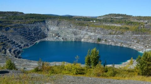
At its height, the Jeffrey mine in Asbestos, Quebec, produced halfof the world’s asbestos. It was the largest open pit asbestos mine on the planet, driving much of Canada’s growth to the largest world asbestos producer […]
Read MoreBy: CATALYST
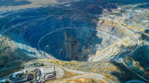
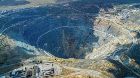
On Monday 7 November 2022, a significant 150m wide breach impacted the eastern wall of the tailings storage facility at the Williamson diamond mine in Tanzania.
Read MoreBy: CATALYST
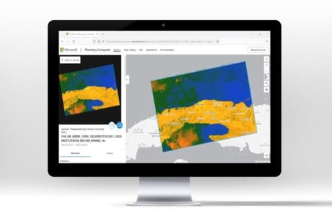
In 2022, CATALYST and Microsoft announced an exciting new collaboration. One that would see more scientists, researchers, and decisions makers around the world get access to earth observation data than ever before. This is the story […]
Read MoreBy: CATALYST
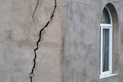
When authorities in Quebec were alerted to the significant risk of landslides in the La Baie area, they immediately set in motion measures to protect lives, property and infrastructure. The problem was, the warnings were only […]
Read MoreBy: CATALYST
This is the story of how Microsoft and CATALYST changed the way scientists, researchers and decision makers around the world could access earth data visualisation and analysis. It was achieved through a truly collaborative approach in […]
Read MoreBy: CATALYST
TORONTO, Sept. 27, 2022 /CNW/ CATALYST today announced that it is enabling simplified access to earth data through Microsoft’s critical initiative, AI for Earth. This collaboration has allowed Microsoft to leverage CATALYST’s trusted science to derive foundational, […]
Read MoreBy: CATALYST
Looking to modernize delivery of high quality imagery faster, KSAT found their solution with CATALYST. Developing a brand new, custom ortho-mosaicking workflow, with pan-sharpening capabilities – CATALYST was able to quickly deliver an efficient solution. The […]
Read MoreBy: CATALYST
PG Ventures, the digital innovation arm of TSR Poland, discovered the powers of CATALYST’s ground displacement data when exploring solutions to address issues related to abandoned mines. What followed was a collaboration – made possible through […]
Read MoreBy: Erica Lemieux
Earth Data, Simplified Check Out Our Preprocessed Interactive Demonstrations We continue our Eastern Seaboard Monitoring Project and are pleased to publish our results on the city of Miami. This is the third city we are monitoring […]
Read MoreBy: Erica Lemieux
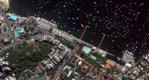
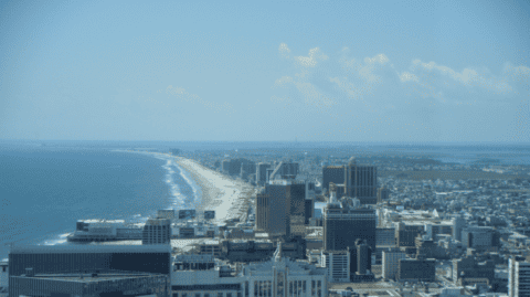
Earth Data, Simplified Check Out Our Preprocessed Interactive Demonstrations As part of our Eastern Seaboard Monitoring Project, we reviewed Atlantic City for potential ground displacement and discovered the following: We continue to review key cities along […]
Read MoreBy: Erica Lemieux
Earth Data, Simplified Check Out Our Preprocessed Interactive Demonstrations As part of our Eastern Seaboard Monitoring Project, we reviewed Washington DC for potential ground displacement and discovered the following: A few months ago, our team began […]
Read MoreBy: CATALYST
Canada’s Pollutant Inventories and Reporting Division (PIRD), a division of Environment and Climate Change Canada (ECCC) faces the massive task of creating a greenhouse gas inventory for the entire nation. A key part of this analysis […]
Read More