You can render pseudo RGB color values to the pixel values of the active raster. By doing so, you can make specific areas of the raster distinctive.
To apply pseudocolors to pixel values in a raster
-
On the Range-based tab of the PCT Editing window, under Color Selection, click Custom, and then do the following, as applicable:
- To select a new starting color, click the box beside First Color, and then in the Select First Color in Range window, select the color at which to start the range.
- To select a new end color, click the box beside Last Color, and then in the Select Last Color in Range window, select the color at which to end the range.
- To apply the new starting and end colors, click Interpolate.
Below First Color and Last Color, the color bar displays the new color range.
-
Under Histogram, do one of the following to define the section to which you want to apply the color range:
- Drag the handles, as applicable.
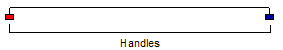 Note: The color of the handles vary according to the selected colors.
 - In the Min X and Max X boxes, type the values you want, respectively.
- Drag the handles, as applicable.
-
If necessary, readjust the marker handles on the color to narrow or widen the color range.
Note: The color of the handles varies according to the selected colors.You can also specify the values of the range in the Left Marker and Right Marker boxes.
-
Under Setup & Preview of New PCT, in the Values Outside Range list, click how to display values outside the range:
- To blacken the area of the histogram that is outside the specified range, click Set to Black.
- To whiten the area of the histogram that is outside the specified range, click Set to White.
- To retain the original color of the histogram outside the specified range, click Ignore.
- Click Stretch.
-
Do one of the following, as applicable:
- To save your edited pseudocolor table, click Save.
- To save your edited pseudocolor table as the default, click Save as Default.