
Earth Data, Simplified
Check Out Our Preprocessed Interactive Demonstrations
As part of our Eastern Seaboard Monitoring Project, we reviewed Atlantic City for potential ground displacement and discovered the following:
- A coastal road is subsiding at 7 mm per year
- Several clusters of oceanside homes are subsiding up to 7 mm per year
- An on-ramp to a causeway is subsiding at 3 mm per year
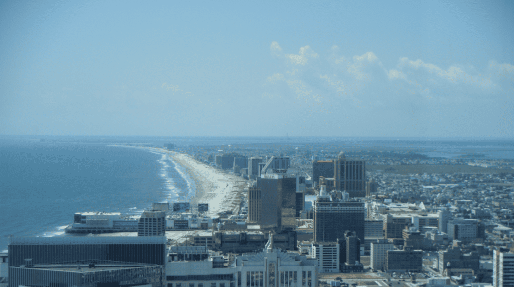
We continue to review key cities along the eastern seaboard of the United States using InSAR and this week we assessed Atlantic City, New Jersey. Since the 1980’s, the US Army Corps of Engineers have pumped 134 million cubic yards of sand across the New Jersey’s coastline, at a cost of over $2 billion. This is to help protect the property and infrastructure, which has been built on top of sinking wetlands and a low-lying coastline. Using satellite radar, we’ve identified several trouble spots that potentially need further attention.
Subsidence Along a Coastal Road
When land subsidence is combined with floods, inundation becomes more severe. Atlantic City is projected to spend $300 million dollars annually on flood related damages, starting in 2030. Areas with low lying coastal infrastructure and properties are most at risk. We identified one coastal road that is subsiding over 7mm per year along several city blocks. This type of subsidence on roadways can cause bumps, cracks, or in extreme cases, sinkholes that will need to be repaved, or completely dug out and replaced depending on the underlying issues. This is costly for governments and taxpayers.
It can also damage sewage and drainage systems as well as water and gas lines, complicating repairs, and increasing maintenance costs.
The subsidence we identified in the image below is also occurring in part of the neighborhood inland from the road, potentially damaging these homes as well.
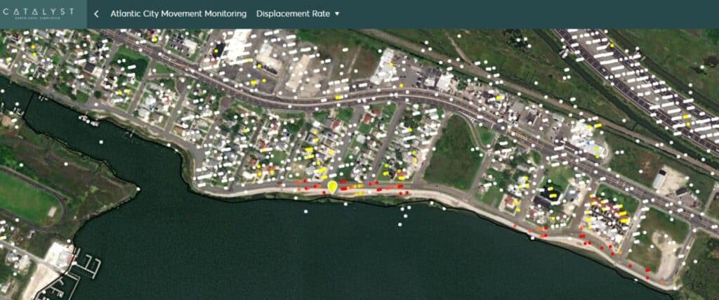
-74.512319, 39.384771
Assessment
- Sinking by 7mm/year (2016-2021)
Risk
- Inspect road and repave as necessary
- Investigate underlying issues of the subsidence
- Ensure proper flood protection is in place
Recommendations
- Inspect slope and runway
- Stabilize/reinforce slope if required
- Continue to monitor closely
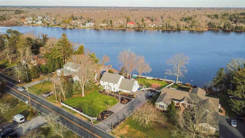
Risk to Residential Properties
Residential homes are most at risk along the Atlantic City shoreline. Even with the construction of flood protection measures provided by various levels of government, rising sea levels and ground subsidence are putting a significant number of properties at risk. We identified several clusters of residential waterfront properties susceptible to subsidence and noted one area subsiding over 7 mm a year. Subsidence-caused structural damage to buildings begins at the foundations, opening the building to leaks. It can also lead to misalignment of doors, tilt, bending, and complete foundational or structural failure. Properties damaged by subsidence can see their values decrease by up to 20%. Many buyers in New Jersey are opting to tear down existing structures and build new ones on stilts to mitigate this risk.
-74.369098, 39.553361
Assessment
- Sinking by 7mm per year (2016-2021)
Risk
- Structural damage
- Reduction in property values
- Increased flood risk
Recommendations
- Inspect home foundations
- Adjust insurance premiums
- Assess flood risks
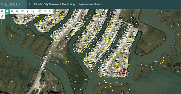
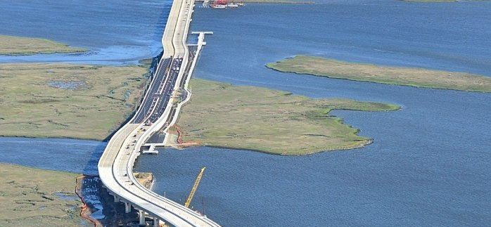
Uneven Subsidence on a Causeway
A major factor in ground subsidence is the permeability of the ground beneath it. Much of Atlantic City resides on sinking wetlands or small islands; one island section of the Stainton Memorial Causeway seems to be impacted by this. The two on-ramps for a visitor centre are subsiding at around 3mm per year, while the rest of the causeway remains stationary. This has the potential to cause cracks where the two roadways join. The causeway was completed in 2012 and now 22,000 cars per day travel on it. Re-routing this traffic will cause congestion on other roads. In 2019, tailbacks cost the US economy $88bn, which equates to $1377 per tailback (source: INRIX.com).
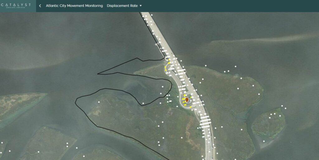
-74.583038, 39.288136
Assessment
- Sinking by 5mm/year (2015-2021)
Risk
- Cracks where the onramp meets the highway
- Cracks spreading to other areas, including the bridge itself or the foundations
Recommendations
- Have the on ramps and surrounding area inspected
- Reinforce the foundations
Please remember, ground displacement can also impact dams, energy grids, pipelines, and many other types of infrastructure. Damage due to ground displacement related geohazards cost many of the world’s economies more money than hurricanes, earthquakes, tornadoes, and floods combined.
This is the second city we have monitored on the Eastern Seaboard and our results can be explored in the available demo. Watch for new findings from future cities and if you would like to contact us to see how we can help you monitor your assets, please use the following email [email protected].
Check Out Our Preprocessed Interactive Demonstrations